Vous êtes ici : La Bibliothèque mayaNEO Bibliothèque · Fiche de catalogue
La Bibliothèque maya · NEO Atlas
Le Grand Atlas maya
par le Bibliothécaire Joséf Sánchez Coach
- Auteur
- Sánchez González, José Fernando
- Sujet
- Monde maya — Cartes · Méso-Amérique — Cartes
- Date
- 2026 · édition 1.0
- Contenu
- 10 planches · 6 parties · 160 lieux · 13 sources
- Langues
- Anglais · Espagnol
Première partie
Le monde maya
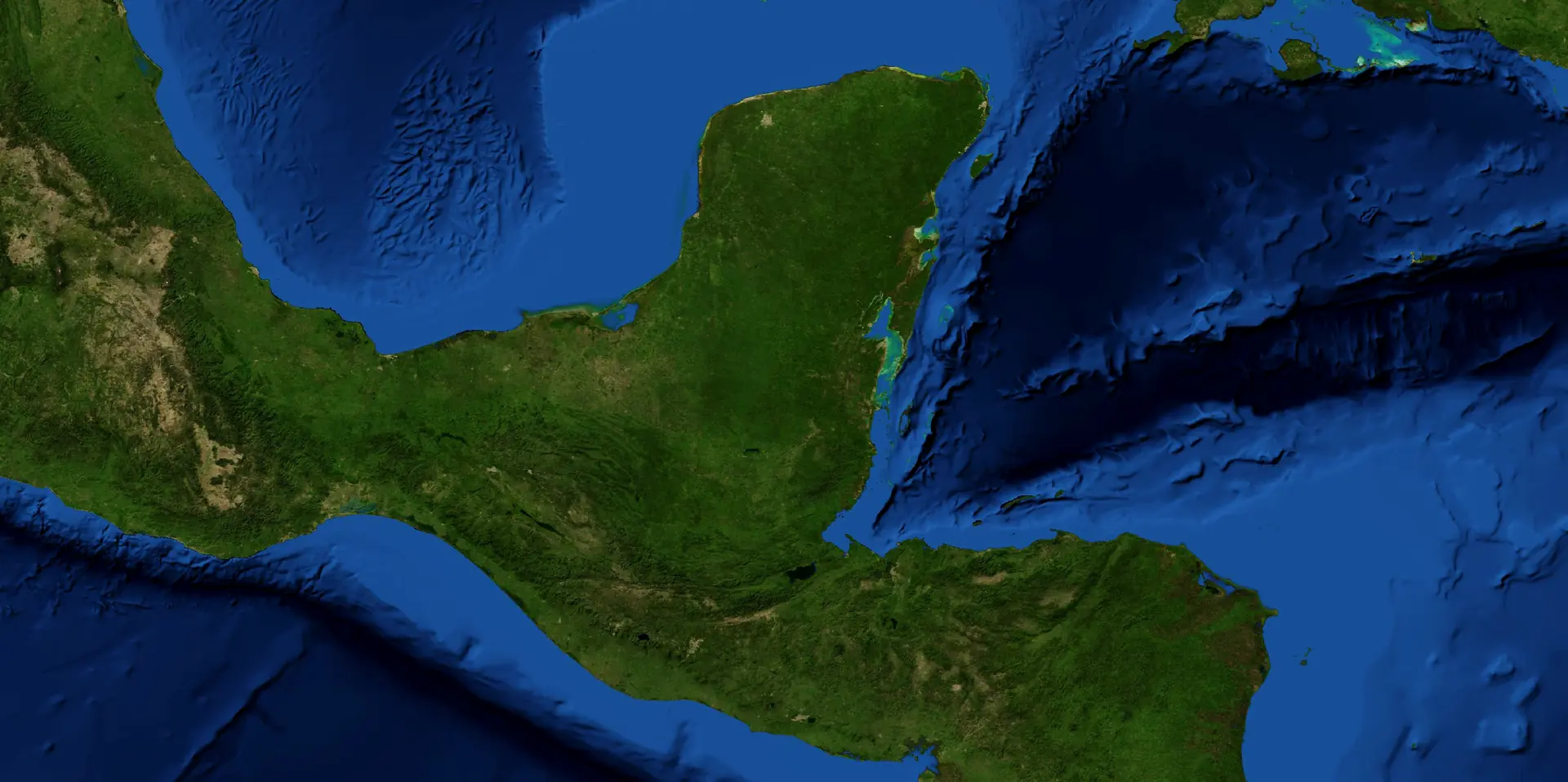
Là où s’étend le monde maya : au cœur de la Méso-Amérique, partagé aujourd’hui par cinq pays.
Planche I · Le monde maya
Le monde maya dans les Amériques
Échelle 1 · Le continent
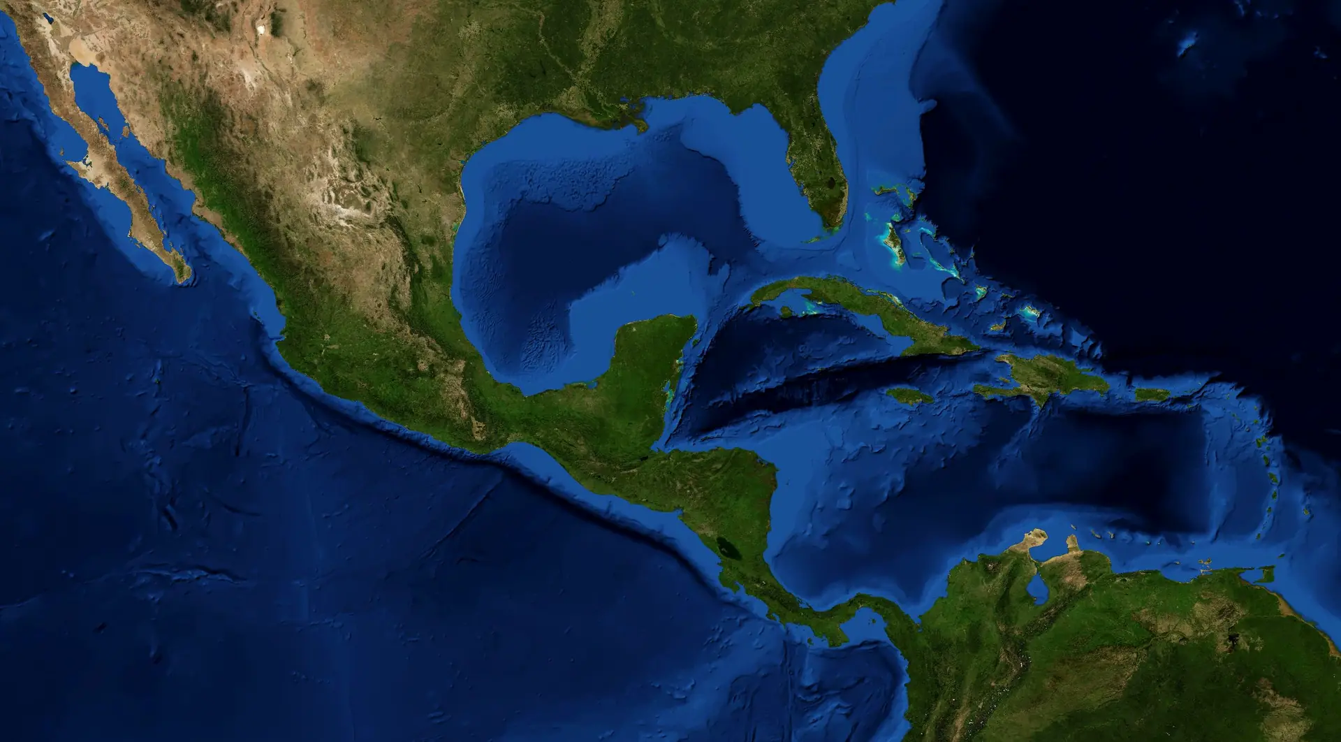
Légende
- Aire maya
- Biorégion maya · terre et mer
- Frontière nationale
Entre le golfe du Mexique, la mer des Caraïbes et l’océan Pacifique, l’aire maya couvre environ 324 000 km² du sud-est du Mexique, du Guatemala, du Belize et des marges occidentales du Honduras et d’El Salvador : le cœur de la Méso-Amérique.
Sources
- NASA Earth Observatory (2005). Blue Marble: Next Generation, with shaded relief and bathymetry. Tiles: FreeTiler, github.com/freetiler/nasa-bluemarble. ↗Imagerie de la NASA, domaine public.
- Natural Earth. Free vector map data, 1:10m (borders, rivers, lakes, isobaths, names). ↗Domaine public.
- NEO Bibliothèque (2026). The Maya Bioregion: area, countries and bioregions. The Mayan Library. ↗© 2026 Bibliothécaire Joséf Sánchez Coach.
Citer cette planche
Sánchez González, José Fernando (2026). “Plate I. The Maya world in the Americas”. The Great Mayan Atlas. The Mayan Library · NEO Bibliothèque. https://mayanlibrary.org/atlas/#maya-world-americas
Plate II · Le monde maya
Cinq pays, une zone maya
Échelle 2 · La biorégion
Légende
- Frontière nationale
- Frontière d’État ou de département
- Capitale nationale
- Capitale d’État ou de département
Le Mexique (Yucatán, Campeche, Quintana Roo, Tabasco et Chiapas), le Guatemala, le Belize et les départements occidentaux du Honduras et d’El Salvador partagent la zone maya. Les frontières sont récentes ; le monde maya est bien plus ancien.
Sources
- Natural Earth. Free vector map data, 1:10m (borders, rivers, lakes, isobaths, names). ↗Domaine public.
- NASA Earth Observatory (2005). Blue Marble: Next Generation, with shaded relief and bathymetry. Tiles: FreeTiler, github.com/freetiler/nasa-bluemarble. ↗Imagerie de la NASA, domaine public.
- NEO Bibliothèque (2026). The Maya Bioregion: area, countries and bioregions. The Mayan Library. ↗© 2026 Bibliothécaire Joséf Sánchez Coach.
56 lieux sur cette planche
- Ahuachapán El Salvador
- Alta Verapaz Guatemala
- Atlántida Honduras
- Baja Verapaz Guatemala
- Belize Belize
- Cabañas El Salvador
- Campeche Mexique
- Cayo Belize
- Chalatenango El Salvador
- Chiapas Mexique
- Chimaltenango Guatemala
- Chiquimula Guatemala
- Comayagua Honduras
- Copán Honduras
- Corozal Belize
- Cortés Honduras
- Cuscatlán El Salvador
- El Progreso Guatemala
- Escuintla Guatemala
- Guatemala Guatemala
- Huehuetenango Guatemala
- Intibucá Honduras
- Izabal Guatemala
- Jalapa Guatemala
- Jutiapa Guatemala
- La Libertad El Salvador
- La Paz Honduras
- La Paz El Salvador
- Lempira Honduras
- Morazán El Salvador
- Ocotepeque Honduras
- Orange Walk Belize
- Petén Guatemala
- Quetzaltenango Guatemala
- Quiché Guatemala
- Quintana Roo Mexique
- Retalhuleu Guatemala
- Sacatepéquez Guatemala
- San Marcos Guatemala
- San Miguel El Salvador
- San Salvador El Salvador
- San Vicente El Salvador
- Santa Ana El Salvador
- Santa Bárbara Honduras
- Santa Rosa Guatemala
- Sololá Guatemala
- Sonsonate El Salvador
- Stann Creek Belize
- Suchitepéquez Guatemala
- Tabasco Mexique
- Toledo Belize
- Totonicapán Guatemala
- Usulután El Salvador
- Yoro Honduras
- Yucatán Mexique
- Zacapa Guatemala
Citer cette planche
Sánchez González, José Fernando (2026). “Plate II. Five countries, one Maya area”. The Great Mayan Atlas. The Mayan Library · NEO Bibliothèque. https://mayanlibrary.org/atlas/#five-countries
Partie II
Terre et Eau
Une péninsule calcaire basse, de hautes montagnes volcaniques, de grands rivières, des eaux souterraines et une mer de récifs.
Planche III · Terre et Eau
Basses terres et hautes terres
Échelle 2 · La biorégion
Légende
- Sommet (mètres)
- Volcan
- Limite approximative des basses terres (Stuart & Stuart, 1977)
- Frontière nationale
La péninsule du Yucatán est une plate-forme calcaire basse. Vers le sud s’élèvent les monts Maya, la Sierra Madre de Chiapas, les Cuchumatanes et la chaîne volcanique du Guatemala, couronnée par le Tajumulco (4 220 m), le plus haut sommet d’Amérique centrale. Copán et Palenque marquent la limite approximative des basses terres mayas (Stuart & Stuart, 1977).
Sources
- NASA Earth Observatory (2005). Blue Marble: Next Generation, with shaded relief and bathymetry. Tiles: FreeTiler, github.com/freetiler/nasa-bluemarble. ↗NASA imagery, public domain.
- Natural Earth. Free vector map data, 1:10m (borders, rivers, lakes, isobaths, names). ↗Public domain.
- Smithsonian Institution, Global Volcanism Program. Volcanoes of the World (positions of the volcanoes). ↗
- Stuart, George E. & Stuart, Gene S. (1977). The Mysterious Maya. Washington, D.C.: National Geographic Society. ↗Map of the Maya lowlands and highlands (page to be confirmed at the next visit).Held at: Biblioteca Central, Universidad Nacional Autónoma de México (UNAM), Ciudad Universitaria · call number F1435 S87© National Geographic Society. Cited, not reproduced.
14 lieux sur cette planche
- Cerro El Pital 2 730 m Sommet (mètres)
- Cerro Las Minas 2 849 m Sommet (mètres)
- Doyle's Delight 1 174 m Sommet (mètres)
- Pico de Orizaba 5 636 m Sommet (mètres)
- Volcán Atitlán Volcan
- Volcán Pacaya Volcan
- Volcán Santa María Volcan
- Volcán Tacaná 4 067 m Sommet (mètres)
- Volcán Tajumulco 4 220 m Sommet (mètres)
- Volcán de Agua Volcan
- Volcán de Fuego Volcan
- Volcán de San Miguel Volcan
- Volcán de San Salvador Volcan
- Volcán de Santa Ana Volcan
Citer cette planche
Sánchez González, José Fernando (2026). “Plate III. Lowlands and highlands”. The Great Mayan Atlas. The Mayan Library · NEO Bibliothèque. https://mayanlibrary.org/atlas/#lowlands-highlands
Planche IV · Terre et Eau
Fleuves, lacs et fond marin
Échelle 2 · La biorégion
Légende
- Fleuve
- Lac ou lagune
- Bord du plateau continental (200 m)
- Profondeur de 1 000 m
- Récif
L’Usumacinta et le Grijalva forment le plus grand réseau hydrographique de la Méso-Amérique ; le Motagua et le Hondo se jettent dans les Caraïbes. La péninsule est presque dépourvue de cours d’eau : la pluie s’infiltre dans le calcaire et ressurgit dans les cénotes. Au large, le banc de Campeche, peu profond, fait face à la fosse des Caïmans, qui dépasse 7 000 m de profondeur, et la barrière de corail méso-américaine longe la côte de Quintana Roo et du Belize.
Sources
- Natural Earth. Free vector map data, 1:10m (borders, rivers, lakes, isobaths, names). ↗Public domain.
- NASA Earth Observatory (2005). Blue Marble: Next Generation, with shaded relief and bathymetry. Tiles: FreeTiler, github.com/freetiler/nasa-bluemarble. ↗NASA imagery, public domain.
88 lieux sur cette planche
- Aguán, fleuve
- Amacuzlac, rivière
- Atoyac, rivière
- Balsas, fleuve
- Blanco, rivière
- Calabazas, rivière
- Candelaria, rivière
- Cazones, rivière
- Chacte, rivière
- Chiflón, rivière
- Chixoy, fleuve
- Choluteca, fleuve
- Coatzacoalcos, fleuve
- Coco, fleuve
- Cuilco, rivière
- El Corte, rivière
- El Salto, rivière
- Grande, rivière
- Grande de Matagalpa, fleuve
- Grijalva, fleuve
- Guayalejo, rivière
- Higuito, rivière
- Hondo, fleuve
- Humuya, rivière
- Jamapa, rivière
- Rivière Jicatuyo
- Rivière Kukalaya
- Rivière Kurinwas
- Rivière La Sierra
- Rivière La Venta
- Rivière Lacantún
- Lac ou lagon Laguna Atasta
- Lac ou lagon Laguna Chil
- Lac ou lagon Laguna Chila
- Lac ou lagon Laguna El Salado
- Lac ou lagon Laguna Mara Lizamba
- Lac ou lagon Laguna Totolcingo
- Lac ou lagon Laguna de Bacalar
- Lac ou lagon Laguna de Ibans
- Lac ou lagon Laguna de Pueblo Viejo
- Lac ou lagon Laguna de Términos
- Lac ou lagon Laguna de Wouhnta
- Lac ou lagon Lake Atitlán
- Lac ou lagon Lake Catemaco
- Lac ou lagon Lake Ilopango
- Lac ou lagon Lake Izabal
- Lac ou lagon Lake Managua
- Lac ou lagon Lake Petén Itzá
- Lac ou lagon Lake Tecocomulco
- Lac ou lagon Lake Texcoco
- Lac ou lagon Lake Yojoa
- Rivière Lempa
- Rivière Lerma
- Rivière Moctezuma
- Rivière Motagua
- Rivière Nexapa
- Rivière Pantepec
- Rivière Papagayo
- Rivière Papaloapan
- Rivière Patuca
- Rivière Pescados
- Rivière Pnuco
- Rivière Polochic
- Lac ou lagon Presa Huapango
- Lac ou lagon Presa Manuel vila Camacho
- Presa Miguel Alemán Lac ou lagon
- Presa Nezahualcóyotl Lac ou lagon
- Presa de la Angostura Lac ou lagon
- Quetzala Rivière
- Quiechapa Rivière
- Salado Rivière
- Salinas Rivière
- San Gregorio Rivière
- San Pedro y San Pablo Rivière
- Santo Domingo Rivière
- Sarabia Rivière
- Sarstún Rivière
- Sinecapa Rivière
- Suchiapa Rivière
- Tacotaipa Rivière
- Tecolutla Rivière
- Tehuantepec Rivière
- Tuma Rivière
- Tzanconeja Rivière
- Ulúa Rivière
- Usumacinta Rivière
- Uxpanapa Rivière
- Verde Rivière
Citer cette planche
Sánchez González, José Fernando (2026). “Plate IV. Rivers, lakes and the sea floor”. The Great Mayan Atlas. The Mayan Library · NEO Bibliothèque. https://mayanlibrary.org/atlas/#rivers-lakes-sea
Partie III
Nature
La forêt maya, la plus grande forêt tropicale des Amériques après l’Amazonie, et les réserves qui protègent la terre et la mer.
Planche V · Nature
La forêt maya et ses biorégions
Échelle 2 · La biorégion
Légende
- Biorégion maya · terre et mer
- Forêts tropicales
- Forêts de montagne
- Récif
Vue depuis l’espace, la civilisation maya forme une forêt. Les forêts tropicales de la péninsule du Yucatán et de l’isthme de Tehuantepec rejoignent les forêts de montagne de la Sierra Madre de Chiapas et des montagnes mayas ; la biorégion s’étend sur les côtes et le récif des Caraïbes.
Sources
- NASA Earth Observatory (2005). Blue Marble: Next Generation, with shaded relief and bathymetry. Tiles: FreeTiler, github.com/freetiler/nasa-bluemarble. ↗Imagerie de la NASA, domaine public.
- NEO Bibliothèque (2026). The Maya Bioregion: area, countries and bioregions. The Mayan Library. ↗© 2026 Bibliothécaire Joséf Sánchez Coach.
- Natural Earth. Free vector map data, 1:10m (borders, rivers, lakes, isobaths, names). ↗Domaine public.
4 lieux sur cette planche
- Isthme de Tehuantepec Forêts tropicales
- Monts Maya Forêts de montagne
- Sierra Madre de Chiapas Forêts de montagne
- Péninsule du Yucatán Forêts tropicales
Citer cette planche
Sánchez González, José Fernando (2026). “Plate V. The Maya forest and its bioregions”. The Great Mayan Atlas. The Mayan Library · NEO Bibliothèque. https://mayanlibrary.org/atlas/#maya-forest-bioregions
Plate VI · Nature
Réserves de biosphère de terre et de mer
Échelle 4 · Les lieux
Légende
- Réserves de biosphère de terre et de mer
Douze zones protégées préservent la forêt, les zones humides et le récif avec lesquels vit le monde maya : de Sian Ka'an et Calakmul à la réserve de biosphère Maya et au Río Plátano.
Sources
- UNESCO Man and the Biosphere Programme. World Network of Biosphere Reserves. ↗
- Comisión Nacional de Áreas Naturales Protegidas (CONANP), México. ↗
- NASA Earth Observatory (2005). Blue Marble: Next Generation, with shaded relief and bathymetry. Tiles: FreeTiler, github.com/freetiler/nasa-bluemarble. ↗Imagerie de la NASA, domaine public.
- Natural Earth. Free vector map data, 1:10m (borders, rivers, lakes, isobaths, names). ↗Domaine public.
12 lieux sur cette planche
- Réserve de biosphère Banco Chinchorro
- Réserve de biosphère de Calakmul
- Parc national Chiquibul
- Réserve de biosphère Los Petenes
- Réserve de biosphère Maya
- Réserve de biosphère Montes Azules
- Réserve de biosphère Pantanos de Centla
- Réserve de biosphère Ría Celestún
- Réserve de biosphère Ría Lagartos
- Réserve de biosphère Río Plátano
- Réserve de biosphère de Sian Ka'an
- Réserve de biosphère de la Sierra de las Minas
Citer cette planche
Sánchez González, José Fernando (2026). “Plate VI. Biosphere reserves of land and sea”. The Great Mayan Atlas. The Mayan Library · NEO Bibliothèque. https://mayanlibrary.org/atlas/#biosphere-reserves
Partie IV
Peuples et langues
Les Mayas forment de nombreux peuples : environ trente langues apparentées réparties en sept familles.
Planche VII · Peuples et langues
Trente peuples mayas et leurs familles linguistiques
Échelle 3 · Les régions
Légende
- Yucatèque
- Ch’olan
- Tseltalan
- Q’anjob’alan
- Mamean
- K’iche’an
- Huastèque
- Chaque numéro désigne un peuple (liste sous la carte).
Les peuples mayas parlent environ trente langues apparentées réparties en sept familles. Chaque numéro indique la région d’origine d’un peuple. Les Teenek (Huastèques) vivent loin au nord-ouest, dans le Veracruz et le San Luis Potosí, en dehors de cette planche.
Sources
- INALI (2008). Catálogo de las Lenguas Indígenas Nacionales. Instituto Nacional de Lenguas Indígenas, México. ↗
- Instituto Nacional de Estadística, Guatemala (2019). XII Censo Nacional de Población y VII de Vivienda 2018. ↗
- NASA Earth Observatory (2005). Blue Marble: Next Generation, with shaded relief and bathymetry. Tiles: FreeTiler, github.com/freetiler/nasa-bluemarble. ↗NASA imagery, public domain.
- Natural Earth. Free vector map data, 1:10m (borders, rivers, lakes, isobaths, names). ↗Public domain.
30 lieux sur cette planche
- Maya yucatèque Yucatèque
- Lacandon Yucatèque
- Itza’ Yucatèque
- Mopan Yucatèque
- Ch’ol Ch’olan
- Chontal (Yokot’an) Ch’olan
- Ch’orti’ Ch’olan
- Tseltal Tseltalan
- Tsotsil Tseltalan
- Tojolabal Q’anjob’alan
- Chuj Q’anjob’alan
- Q’anjob’al Q’anjob’alan
- Akateko Q’anjob’alan
- Jakalteko (Popti’) Q’anjob’alan
- Mam Mamean
- Tectitèque maméenne
- Awakatèque maméenne
- Ixil maméenne
- Sacapultec kichée
- Sipacapense kichée
- K’iche’ kichée
- Uspantek kichée
- Tz’utujil kichée
- Kaqchikel kichée
- Achi kichée
- Poqomchi’ kichée
- Poqomam kichée
- Q’eqchi’ kichée
- Teenek (huastèque) huastèque
- Qato’k (mocho’) q’anjob’alane
Citer cette planche
Sánchez González, José Fernando (2026). “Plate VII. Thirty Maya peoples and their language families”. The Great Mayan Atlas. The Mayan Library · NEO Bibliothèque. https://mayanlibrary.org/atlas/#maya-peoples-languages
Partie V
Cités antiques
Les cités des anciens Maya : la carte d’un livre de la Bibliothèque centrale de l’UNAM et les grandes pyramides.
Planche VIII · Cités antiques
Les lieux de The Mysterious Maya (1977)
Échelle 3 · Les régions
Légende
- Site archéologique
- Localité d’intérêt archéologique
- Ville ou bourg
- Volcan
Les 72 lieux imprimés sur la carte des basses et hautes terres mayas dans The Mysterious Maya (National Geographic Society, 1977) : sites archéologiques, localités d’intérêt archéologique, villes et bourgs, ainsi que le volcan Ilopango. Copán et Palenque marquent les limites approximatives des basses terres, où la civilisation maya classique a atteint son apogée.
Conception de cette planche
Redessiné par le Bibliothécaire Joséf Sánchez Coach : les lieux sont ceux imprimés dans le livre ; leurs positions ont été établies par NEO (WGS 84) sur le relief de la NASA. Cette planche n’est pas une reproduction de la carte imprimée.
Sources
- Stuart, George E. & Stuart, Gene S. (1977). The Mysterious Maya. Washington, D.C.: National Geographic Society. ↗Carte des basses et hautes terres mayas (page à confirmer lors de la prochaine visite).Conservé à : Biblioteca Central, Universidad Nacional Autónoma de México (UNAM), Ciudad Universitaria · cote F1435 S87© National Geographic Society. Cité, non reproduit.
- NASA Earth Observatory (2005). Blue Marble: Next Generation, with shaded relief and bathymetry. Tiles: FreeTiler, github.com/freetiler/nasa-bluemarble. ↗Imagerie de la NASA, domaine public.
- Natural Earth. Données cartographiques vectorielles libres, 1:10m (frontières, rivières, lacs, isobathes, noms). ↗Domaine public.
72 lieux sur cette planche
- Abaj Takalik Site archéologique
- Altun Ha Site archéologique
- Amatenango Ville ou bourg
- Barton Ramie Site archéologique
- Becán Site archéologique
- Belize City Ville ou bourg
- Belmopan Ville ou bourg
- Bonampak Site archéologique
- Calakmul Site archéologique
- Campeche Ville ou bourg
- Chalchuapa Site archéologique
- Champotón Ville ou bourg
- Chamula Ville ou bourg
- Chemax Ville ou bourg
- Chetumal Ville ou bourg
- Chiapa de Corzo Lieu habité d’importance archéologique
- Chicanná Site archéologique
- Chichicastenango Ville ou bourg
- Chichén Itzá Site archéologique
- Chumayel Ville ou bourg
- Cobá Site archéologique
- Copán Site archéologique
- Dzibilchaltún Site archéologique
- El Mirador Site archéologique
- Felipe Carrillo Puerto (Chan Santa Cruz) Ville ou bourg
- Flores (Tayasal) Lieu habité d’importance archéologique
- Guatemala City Ville ou bourg
- Huehuetenango Ville ou bourg
- Ilopango Volcano Volcan
- Iximché Site archéologique
- Izamal Ville ou bourg
- Jaina Site archéologique
- Kabah Site archéologique
- Kaminaljuyú Site archéologique
- La Naya Site archéologique
- Labná Site archéologique
- Maní Ville ou bourg
- Mayapán Site archéologique
- Mixco Viejo Site archéologique
- Muna Ville ou bourg
- Mérida (Tihó) Ville ou bourg
- Nabenchauk Ville ou bourg
- Naranjo Site archéologique
- Nebaj Ville ou bourg
- Oxkutzcab Ville ou bourg
- Palenque Site archéologique
- Piedras Negras Site archéologique
- Progreso Ville ou bourg
- Quetzaltenango Ville ou bourg
- Quiriguá Site archéologique
- San Cristóbal de Las Casas Ville ou bourg
- San Salvador Ville ou bourg
- Sayaxché Ville ou bourg
- Sayil Site archéologique
- Seibal (Ceibal) Site archéologique
- Sitilpech Ville ou bourg
- Sololá Ville ou bourg
- Sotuta Ville ou bourg
- Tazumal Site archéologique
- Telchaquillo Ville ou bourg
- Tenejapa Ville ou bourg
- Tikal Site archéologique
- Tulum Site archéologique
- Tuxtla Gutiérrez Ville ou bourg
- Uaxactún Site archéologique
- Utatlán (Q'umarkaj) Site archéologique
- Uxmal Site archéologique
- Valladolid (Saki) Ville ou bourg
- Villahermosa Ville ou bourg
- Yaxachén (Yaxhachén) Ville ou bourg
- Yaxchilán Site archéologique
- Zinacantán Ville ou bourg
Citer cette planche
Sánchez González, José Fernando (2026). “Plate VIII. The places of The Mysterious Maya (1977)”. The Great Mayan Atlas. The Mayan Library · NEO Bibliothèque. https://mayanlibrary.org/atlas/#lowlands-highlands-1977
Planche IX · Cités antiques
Les grandes pyramides du monde maya
Échelle 4 · Les lieux
Légende
- Les grandes pyramides du monde maya
Vingt et une grandes pyramides et temples, d’El Castillo à Chichén Itzá jusqu’à l’acropole de Copán : le cœur monumental des cités mayas antiques.
Sources
- Instituto Nacional de Antropología e Historia (INAH). Zonas arqueológicas de México. ↗
- Centre du patrimoine mondial de l’UNESCO. Liste du patrimoine mondial : Mexique, Guatemala, Belize, Honduras. ↗
- NASA Earth Observatory (2005). Blue Marble: Next Generation, with shaded relief and bathymetry. Tiles: FreeTiler, github.com/freetiler/nasa-bluemarble. ↗NASA imagery, public domain.
- Natural Earth. Free vector map data, 1:10m (borders, rivers, lakes, isobaths, names). ↗Public domain.
21 lieux sur cette planche
- Acropole · Copán
- Acropole · Ek' Balam
- Altun Ha
- Becán
- Caana · Caracol
- Comalcalco
- Dzibanché
- Edzná
- El Castillo · Chichén Itzá
- El Castillo · Xunantunich
- Grand Temple · Lamanai
- Kohunlich
- Kukulcán · Mayapán
- La Danta · El Mirador
- Nohoch Mul · Cobá
- Pyramide du Devin · Uxmal
- Structure II · Calakmul
- Temple I · Tikal
- Temple des Inscriptions · Palenque
- Toniná
- Yaxchilán
Citer cette planche
Sánchez González, José Fernando (2026). “Plate IX. The great pyramids of the Maya world”. The Great Mayan Atlas. The Mayan Library · NEO Bibliothèque. https://mayanlibrary.org/atlas/#great-pyramids
Partie VI
Le monde maya aujourd’hui
Comment voyager dans le monde maya aujourd’hui : en train, en avion et par la mer.
Planche X · Le monde maya aujourd’hui
Train, avion et mer : les routes d’aujourd’hui
Échelle 3 · Les régions
Légende
- Station du Tren Maya
- Aéroport
- Port de croisière ou de ferry
Le Tren Maya boucle la péninsule du Yucatán et dessert Palenque ; des aéroports internationaux relient Cancún, Mérida, Flores, Belize City et Guatemala City au reste du monde ; les ports de croisière et de ferry ouvrent la côte caribéenne.
Sources
- Tren Maya, Gobierno de México. Stations and route. ↗
- NEO Bibliothèque (2026). Airports, ports and stations of the Maya Bioregion, from the public information of their operators. The Mayan Library. ↗© 2026 Bibliothécaire Joséf Sánchez Coach.
- NASA Earth Observatory (2005). Blue Marble: Next Generation, with shaded relief and bathymetry. Tiles: FreeTiler, github.com/freetiler/nasa-bluemarble. ↗NASA imagery, public domain.
- Natural Earth. Free vector map data, 1:10m (borders, rivers, lakes, isobaths, names). ↗Public domain.
28 lieux sur cette planche
- Port de croisière de Belize City Cruise or ferry port
- Belize City · Philip Goldson Airport
- Aéroport de Campeche Airport
- Aéroport international de Cancún Airport
- Aéroport international de Chetumal Airport
- Costa Maya · Mahahual Cruise or ferry port
- Aéroport international de Cozumel Airport
- Port de croisière de Cozumel Cruise or ferry port
- Flores · Mundo Maya Airport
- Guatemala City · La Aurora Airport
- Aéroport international de Mérida Airport
- Aéroport international de Palenque Airport
- Port de croisière de Progreso Cruise or ferry port
- Puerto Juárez · Ferries de Cancún Cruise or ferry port
- Port de croisière de Roatán Cruise or ferry port
- Santo Tomás de Castilla Cruise or ferry port
- Tren Maya · Bacalar Tren Maya station
- Tren Maya · Calakmul Tren Maya station
- Tren Maya · Campeche Tren Maya station
- Tren Maya · Aéroport de Cancún Tren Maya station
- Tren Maya · Chichén Itzá Tren Maya station
- Tren Maya · Mérida Tren Maya station
- Tren Maya · Palenque Tren Maya station
- Tren Maya · Playa del Carmen Tren Maya station
- Tren Maya · Tulum Tren Maya station
- Tren Maya · Valladolid Tren Maya station
- Aéroport international de Tulum Airport
- Aéroport international de Villahermosa Airport
Citer cette planche
Sánchez González, José Fernando (2026). “Plate X. Train, air and sea: the routes of today”. The Great Mayan Atlas. The Mayan Library · NEO Bibliothèque. https://mayanlibrary.org/atlas/#routes-today
Planches suivantes
Échelle 5 · En préparation
Tikal · plan de la ville
Source en cours de révision à la Bibliothèque centrale de l’UNAM.
Échelle 5 · En préparation
Palenque · plan de la ville
Source en cours de révision à la Bibliothèque centrale de l’UNAM.
Échelle 5 · En préparation
Chichén Itzá · plan de la ville
Source en cours de révision à la Bibliothèque centrale de l’UNAM.
Échelle 6 · En préparation
El Castillo · la pyramide comme calendrier
Planche en préparation.
Comment l’atlas est construit
La source en main
Un livre de la Bibliothèque centrale de l’UNAM, une archive ou des données ouvertes : photographié et enregistré avec sa cote et sa page.
Dans l’Autorité NEO
Chaque lieu devient une notice avec son nom tel qu’imprimé, ses coordonnées et sa source.
Redessiné par NEO
Chaque planche est dessinée sur le relief de la NASA avec des données ouvertes. Les cartes imprimées sous droit d’auteur sont citées, jamais copiées.
Révisé par le bibliothécaire
Les noms, les positions et les citations sont vérifiés avant la publication d’une planche.
Publié en quatre langues
Anglais, espagnol, français et portugais, chacun avec sa propre adresse, pour les personnes, les moteurs de recherche et l’IA.
Réalisé par le Bibliothécaire Joséf Sánchez Coach avec l’aide d’outils d’IA ; il est l’auteur de cet atlas.
Sources de l’atlas
- NASA Earth Observatory (2005). Blue Marble: Next Generation, avec relief ombré et bathymétrie. Tuiles : FreeTiler, github.com/freetiler/nasa-bluemarble. ↗Imagerie NASA, domaine public.
- Natural Earth. Données vectorielles libres, 1:10m (frontières, rivières, lacs, isobathes, noms). ↗Domaine public.
- NEO Bibliothèque (2026). The Maya Bioregion: area, countries and bioregions. The Mayan Library. ↗© 2026 Bibliothécaire Joséf Sánchez Coach.
- Smithsonian Institution, Global Volcanism Program. Volcanoes of the World (positions des volcans). ↗
- Stuart, George E. & Stuart, Gene S. (1977). The Mysterious Maya. Washington, D.C.: National Geographic Society. ↗Carte des basses terres et hautes terres mayas (page à confirmer lors de la prochaine visite).Conservé à : Biblioteca Central, Universidad Nacional Autónoma de México (UNAM), Ciudad Universitaria · cote F1435 S87© National Geographic Society. Cité, non reproduit.
- UNESCO Man and the Biosphere Programme. World Network of Biosphere Reserves. ↗
- Comisión Nacional de Áreas Naturales Protegidas (CONANP), México. ↗
- INALI (2008). Catálogo de las Lenguas Indígenas Nacionales. Instituto Nacional de Lenguas Indígenas, México. ↗
- Instituto Nacional de Estadística, Guatemala (2019). XII Censo Nacional de Población y VII de Vivienda 2018. ↗
- Instituto Nacional de Antropología e Historia (INAH). Zonas arqueológicas de México. ↗
- UNESCO World Heritage Centre. World Heritage List: Mexico, Guatemala, Belize, Honduras. ↗
- Tren Maya, Gouvernement du Mexique. Gares et itinéraire. ↗
- NEO Bibliothèque (2026). Aéroports, ports et gares de la biorégion maya, d’après les informations publiques de leurs opérateurs. La Bibliothèque Maya. ↗© 2026 Bibliothécaire Joséf Sánchez Coach.
Citer l’atlas
Sánchez González, José Fernando (2026). The Great Mayan Atlas. La Bibliothèque Maya · NEO Bibliothèque. https://mayanlibrary.org/atlas/
La Bibliothèque Maya
Votre lecture maya gratuite
Votre signe du jour dans le compte sacré, interprété pour vous par le bibliothécaire.
★ Obtenez votre lecture gratuite