You are here: The Mayan LibraryNEO Library · Catalog card
The Mayan Library · NEO Atlas
The Great Mayan Atlas
by Librarian Joséf Sánchez Coach
- Author
- Sánchez González, José Fernando
- Subject
- Maya world — Maps · Mesoamerica — Maps
- Date
- 2026 · edition 1.0
- Contents
- 10 plates · 6 parts · 160 places · 13 sources
- Languages
- English · Español
Part I
The Maya World
Where the Maya world lies: at the heart of Mesoamerica, shared today by five countries.
Plate I · The Maya World
The Maya world in the Americas
Scale 1 · The continent
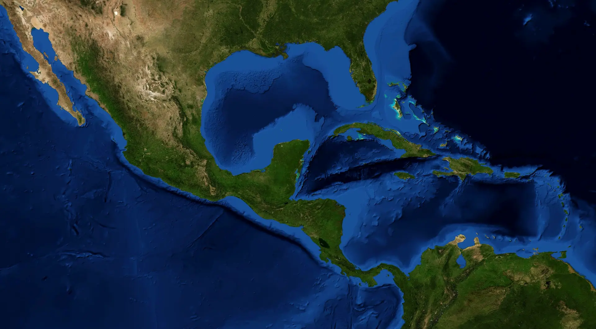
Between the Gulf of Mexico, the Caribbean Sea and the Pacific Ocean, the Maya area covers about 324,000 km² of south-east Mexico, Guatemala, Belize and the western edges of Honduras and El Salvador: the heart of Mesoamerica.
Sources
- NASA Earth Observatory (2005). Blue Marble: Next Generation, with shaded relief and bathymetry. Tiles: FreeTiler, github.com/freetiler/nasa-bluemarble. ↗NASA imagery, public domain.
- Natural Earth. Free vector map data, 1:10m (borders, rivers, lakes, isobaths, names). ↗Public domain.
- NEO Library (2026). The Maya Bioregion: area, countries and bioregions. The Mayan Library. ↗© 2026 Librarian Joséf Sánchez Coach.
Cite this plate
Sánchez González, José Fernando (2026). “Plate I. The Maya world in the Americas”. The Great Mayan Atlas. The Mayan Library · NEO Library. https://mayanlibrary.org/atlas/#maya-world-americas
Plate II · The Maya World
Five countries, one Maya area
Scale 2 · The bioregion
Mexico (Yucatán, Campeche, Quintana Roo, Tabasco and Chiapas), Guatemala, Belize and the western departments of Honduras and El Salvador share the Maya area. The borders are recent; the Maya world is much older.
Sources
- Natural Earth. Free vector map data, 1:10m (borders, rivers, lakes, isobaths, names). ↗Public domain.
- NASA Earth Observatory (2005). Blue Marble: Next Generation, with shaded relief and bathymetry. Tiles: FreeTiler, github.com/freetiler/nasa-bluemarble. ↗NASA imagery, public domain.
- NEO Library (2026). The Maya Bioregion: area, countries and bioregions. The Mayan Library. ↗© 2026 Librarian Joséf Sánchez Coach.
56 places on this plate
- Ahuachapán El Salvador
- Alta Verapaz Guatemala
- Atlántida Honduras
- Baja Verapaz Guatemala
- Belize Belize
- Cabañas El Salvador
- Campeche Mexico
- Cayo Belize
- Chalatenango El Salvador
- Chiapas Mexico
- Chimaltenango Guatemala
- Chiquimula Guatemala
- Comayagua Honduras
- Copán Honduras
- Corozal Belize
- Cortés Honduras
- Cuscatlán El Salvador
- El Progreso Guatemala
- Escuintla Guatemala
- Guatemala Guatemala
- Huehuetenango Guatemala
- Intibucá Honduras
- Izabal Guatemala
- Jalapa Guatemala
- Jutiapa Guatemala
- La Libertad El Salvador
- La Paz Honduras
- La Paz El Salvador
- Lempira Honduras
- Morazán El Salvador
- Ocotepeque Honduras
- Orange Walk Belize
- Petén Guatemala
- Quetzaltenango Guatemala
- Quiché Guatemala
- Quintana Roo Mexico
- Retalhuleu Guatemala
- Sacatepéquez Guatemala
- San Marcos Guatemala
- San Miguel El Salvador
- San Salvador El Salvador
- San Vicente El Salvador
- Santa Ana El Salvador
- Santa Bárbara Honduras
- Santa Rosa Guatemala
- Sololá Guatemala
- Sonsonate El Salvador
- Stann Creek Belize
- Suchitepéquez Guatemala
- Tabasco Mexico
- Toledo Belize
- Totonicapán Guatemala
- Usulután El Salvador
- Yoro Honduras
- Yucatán Mexico
- Zacapa Guatemala
Cite this plate
Sánchez González, José Fernando (2026). “Plate II. Five countries, one Maya area”. The Great Mayan Atlas. The Mayan Library · NEO Library. https://mayanlibrary.org/atlas/#five-countries
Part II
Land and Water
A low limestone peninsula, high volcanic mountains, great rivers, water under the ground and a sea of reefs.
Plate III · Land and Water
Lowlands and highlands
Scale 2 · The bioregion
The Yucatán Peninsula is a low limestone platform. To the south rise the Maya Mountains, the Sierra Madre de Chiapas, the Cuchumatanes and the volcanic chain of Guatemala, crowned by Tajumulco (4,220 m), the highest summit of Central America. Copán and Palenque mark the approximate limit of the Maya lowlands (Stuart & Stuart, 1977).
Sources
- NASA Earth Observatory (2005). Blue Marble: Next Generation, with shaded relief and bathymetry. Tiles: FreeTiler, github.com/freetiler/nasa-bluemarble. ↗NASA imagery, public domain.
- Natural Earth. Free vector map data, 1:10m (borders, rivers, lakes, isobaths, names). ↗Public domain.
- Smithsonian Institution, Global Volcanism Program. Volcanoes of the World (positions of the volcanoes). ↗
- Stuart, George E. & Stuart, Gene S. (1977). The Mysterious Maya. Washington, D.C.: National Geographic Society. ↗Map of the Maya lowlands and highlands (page to be confirmed at the next visit).Held at: Biblioteca Central, Universidad Nacional Autónoma de México (UNAM), Ciudad Universitaria · call number F1435 S87© National Geographic Society. Cited, not reproduced.
14 places on this plate
- Cerro El Pital 2,730 m Summit (metres)
- Cerro Las Minas 2,849 m Summit (metres)
- Doyle's Delight 1,174 m Summit (metres)
- Pico de Orizaba 5,636 m Summit (metres)
- Volcán Atitlán Volcano
- Volcán Pacaya Volcano
- Volcán Santa María Volcano
- Volcán Tacaná 4,067 m Summit (metres)
- Volcán Tajumulco 4,220 m Summit (metres)
- Volcán de Agua Volcano
- Volcán de Fuego Volcano
- Volcán de San Miguel Volcano
- Volcán de San Salvador Volcano
- Volcán de Santa Ana Volcano
Cite this plate
Sánchez González, José Fernando (2026). “Plate III. Lowlands and highlands”. The Great Mayan Atlas. The Mayan Library · NEO Library. https://mayanlibrary.org/atlas/#lowlands-highlands
Plate IV · Land and Water
Rivers, lakes and the sea floor
Scale 2 · The bioregion
The Usumacinta and the Grijalva form the largest river system of Mesoamerica; the Motagua and the Hondo run to the Caribbean. The peninsula has almost no rivers: the rain sinks into the limestone and comes back to light in the cenotes. Offshore, the shallow Campeche Bank faces the Cayman Trough, more than 7,000 m deep, and the Mesoamerican Reef follows the coast of Quintana Roo and Belize.
Sources
- Natural Earth. Free vector map data, 1:10m (borders, rivers, lakes, isobaths, names). ↗Public domain.
- NASA Earth Observatory (2005). Blue Marble: Next Generation, with shaded relief and bathymetry. Tiles: FreeTiler, github.com/freetiler/nasa-bluemarble. ↗NASA imagery, public domain.
88 places on this plate
- Aguán River
- Amacuzlac River
- Atoyac River
- Balsas River
- Blanco River
- Calabazas River
- Candelaria River
- Cazones River
- Chacte River
- Chiflón River
- Chixoy River
- Choluteca River
- Coatzacoalcos River
- Coco River
- Cuilco River
- El Corte River
- El Salto River
- Grande River
- Grande de Matagalpa River
- Grijalva River
- Guayalejo River
- Higuito River
- Hondo River
- Humuya River
- Jamapa River
- Jicatuyo River
- Kukalaya River
- Kurinwas River
- La Sierra River
- La Venta River
- Lacantún River
- Laguna Atasta Lake or lagoon
- Laguna Chil Lake or lagoon
- Laguna Chila Lake or lagoon
- Laguna El Salado Lake or lagoon
- Laguna Mara Lizamba Lake or lagoon
- Laguna Totolcingo Lake or lagoon
- Laguna de Bacalar Lake or lagoon
- Laguna de Ibans Lake or lagoon
- Laguna de Pueblo Viejo Lake or lagoon
- Laguna de Términos Lake or lagoon
- Laguna de Wouhnta Lake or lagoon
- Lake Atitlán Lake or lagoon
- Lake Catemaco Lake or lagoon
- Lake Ilopango Lake or lagoon
- Lake Izabal Lake or lagoon
- Lake Managua Lake or lagoon
- Lake Petén Itzá Lake or lagoon
- Lake Tecocomulco Lake or lagoon
- Lake Texcoco Lake or lagoon
- Lake Yojoa Lake or lagoon
- Lempa River
- Lerma River
- Moctezuma River
- Motagua River
- Nexapa River
- Pantepec River
- Papagayo River
- Papaloapan River
- Patuca River
- Pescados River
- Pnuco River
- Polochic River
- Presa Huapango Lake or lagoon
- Presa Manuel vila Camacho Lake or lagoon
- Presa Miguel Alemán Lake or lagoon
- Presa Nezahualcóyotl Lake or lagoon
- Presa de la Angostura Lake or lagoon
- Quetzala River
- Quiechapa River
- Salado River
- Salinas River
- San Gregorio River
- San Pedro y San Pablo River
- Santo Domingo River
- Sarabia River
- Sarstún River
- Sinecapa River
- Suchiapa River
- Tacotaipa River
- Tecolutla River
- Tehuantepec River
- Tuma River
- Tzanconeja River
- Ulúa River
- Usumacinta River
- Uxpanapa River
- Verde River
Cite this plate
Sánchez González, José Fernando (2026). “Plate IV. Rivers, lakes and the sea floor”. The Great Mayan Atlas. The Mayan Library · NEO Library. https://mayanlibrary.org/atlas/#rivers-lakes-sea
Part III
Nature
The Maya forest, the largest tropical forest of the Americas after the Amazon, and the reserves that protect land and sea.
Plate V · Nature
The Maya forest and its bioregions
Scale 2 · The bioregion
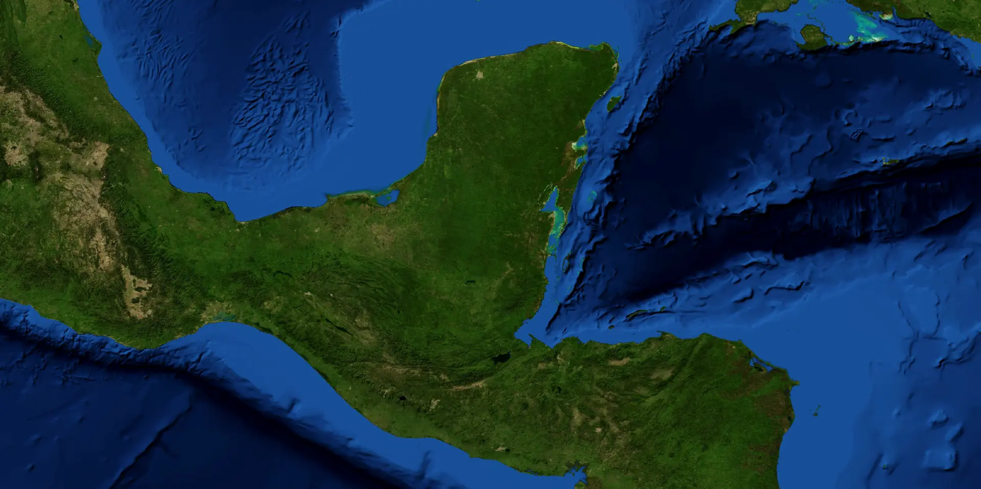
Seen from space, the Maya world is a forest. The tropical forests of the Yucatán Peninsula and the Isthmus of Tehuantepec meet the mountain forests of the Sierra Madre de Chiapas and the Maya Mountains; the bioregion reaches over the coasts and the Caribbean reef.
Sources
- NASA Earth Observatory (2005). Blue Marble: Next Generation, with shaded relief and bathymetry. Tiles: FreeTiler, github.com/freetiler/nasa-bluemarble. ↗NASA imagery, public domain.
- NEO Library (2026). The Maya Bioregion: area, countries and bioregions. The Mayan Library. ↗© 2026 Librarian Joséf Sánchez Coach.
- Natural Earth. Free vector map data, 1:10m (borders, rivers, lakes, isobaths, names). ↗Public domain.
4 places on this plate
- Isthmus of Tehuantepec Tropical forests
- Maya Mountains Mountain forests
- Sierra Madre de Chiapas Mountain forests
- Yucatán Peninsula Tropical forests
Cite this plate
Sánchez González, José Fernando (2026). “Plate V. The Maya forest and its bioregions”. The Great Mayan Atlas. The Mayan Library · NEO Library. https://mayanlibrary.org/atlas/#maya-forest-bioregions
Plate VI · Nature
Biosphere reserves of land and sea
Scale 4 · The places
Twelve protected areas keep the forest, the wetlands and the reef that the Maya world lives with: from Sian Ka'an and Calakmul to the Maya Biosphere Reserve and Río Plátano.
Sources
- UNESCO Man and the Biosphere Programme. World Network of Biosphere Reserves. ↗
- Comisión Nacional de Áreas Naturales Protegidas (CONANP), México. ↗
- NASA Earth Observatory (2005). Blue Marble: Next Generation, with shaded relief and bathymetry. Tiles: FreeTiler, github.com/freetiler/nasa-bluemarble. ↗NASA imagery, public domain.
- Natural Earth. Free vector map data, 1:10m (borders, rivers, lakes, isobaths, names). ↗Public domain.
12 places on this plate
- Banco Chinchorro Biosphere Reserve
- Calakmul Biosphere Reserve
- Chiquibul National Park
- Los Petenes Biosphere Reserve
- Maya Biosphere Reserve
- Montes Azules Biosphere Reserve
- Pantanos de Centla Biosphere Reserve
- Ría Celestún Biosphere Reserve
- Ría Lagartos Biosphere Reserve
- Río Plátano Biosphere Reserve
- Sian Ka'an Biosphere Reserve
- Sierra de las Minas Biosphere Reserve
Cite this plate
Sánchez González, José Fernando (2026). “Plate VI. Biosphere reserves of land and sea”. The Great Mayan Atlas. The Mayan Library · NEO Library. https://mayanlibrary.org/atlas/#biosphere-reserves
Part IV
Peoples and Languages
The Maya are many peoples: about thirty related languages in seven families.
Plate VII · Peoples and Languages
Thirty Maya peoples and their language families
Scale 3 · The regions
The Maya peoples speak about thirty related languages in seven families. Each number marks the home region of one people. The Teenek (Huastec) live far to the north-west, in Veracruz and San Luis Potosí, outside this plate.
Sources
- INALI (2008). Catálogo de las Lenguas Indígenas Nacionales. Instituto Nacional de Lenguas Indígenas, México. ↗
- Instituto Nacional de Estadística, Guatemala (2019). XII Censo Nacional de Población y VII de Vivienda 2018. ↗
- NASA Earth Observatory (2005). Blue Marble: Next Generation, with shaded relief and bathymetry. Tiles: FreeTiler, github.com/freetiler/nasa-bluemarble. ↗NASA imagery, public domain.
- Natural Earth. Free vector map data, 1:10m (borders, rivers, lakes, isobaths, names). ↗Public domain.
30 places on this plate
- Yucatec Maya Yucatecan
- Lacandon Yucatecan
- Itza' Yucatecan
- Mopan Yucatecan
- Ch'ol Ch'olan
- Chontal (Yokot'an) Ch'olan
- Ch'orti' Ch'olan
- Tseltal Tseltalan
- Tsotsil Tseltalan
- Tojolabal Q'anjob'alan
- Chuj Q'anjob'alan
- Q'anjob'al Q'anjob'alan
- Akateko Q'anjob'alan
- Jakalteko (Popti') Q'anjob'alan
- Mam Mamean
- Tektiteko Mamean
- Awakateko Mamean
- Ixil Mamean
- Sakapulteko K'iche'an
- Sipakapense K'iche'an
- K'iche' K'iche'an
- Uspanteko K'iche'an
- Tz'utujil K'iche'an
- Kaqchikel K'iche'an
- Achi K'iche'an
- Poqomchi' K'iche'an
- Poqomam K'iche'an
- Q'eqchi' K'iche'an
- Teenek (Huastec) Huastecan
- Qato'k (Mocho') Q'anjob'alan
Cite this plate
Sánchez González, José Fernando (2026). “Plate VII. Thirty Maya peoples and their language families”. The Great Mayan Atlas. The Mayan Library · NEO Library. https://mayanlibrary.org/atlas/#maya-peoples-languages
Part V
Ancient Cities
The cities of the ancient Maya: the map of a book of the UNAM Central Library, and the great pyramids.
Plate VIII · Ancient Cities
The places of The Mysterious Maya (1977)
Scale 3 · The regions
The 72 places printed on the map of the Maya lowlands and highlands in The Mysterious Maya (National Geographic Society, 1977): archaeological sites, populated places of archaeological importance, cities and towns, and the Ilopango volcano. Copán and Palenque mark the approximate limits of the lowlands, where Classic Maya civilization reached its zenith.
How this plate was made
Redrawn by Librarian Joséf Sánchez Coach: the places are those printed in the book; their positions were set by NEO (WGS 84) on the NASA relief. This plate is not a reproduction of the printed map.
Sources
- Stuart, George E. & Stuart, Gene S. (1977). The Mysterious Maya. Washington, D.C.: National Geographic Society. ↗Map of the Maya lowlands and highlands (page to be confirmed at the next visit).Held at: Biblioteca Central, Universidad Nacional Autónoma de México (UNAM), Ciudad Universitaria · call number F1435 S87© National Geographic Society. Cited, not reproduced.
- NASA Earth Observatory (2005). Blue Marble: Next Generation, with shaded relief and bathymetry. Tiles: FreeTiler, github.com/freetiler/nasa-bluemarble. ↗NASA imagery, public domain.
- Natural Earth. Free vector map data, 1:10m (borders, rivers, lakes, isobaths, names). ↗Public domain.
72 places on this plate
- Abaj Takalik Archaeological site
- Altun Ha Archaeological site
- Amatenango City or town
- Barton Ramie Archaeological site
- Becán Archaeological site
- Belize City City or town
- Belmopan City or town
- Bonampak Archaeological site
- Calakmul Archaeological site
- Campeche City or town
- Chalchuapa City or town
- Champotón City or town
- Chamula City or town
- Chemax City or town
- Chetumal City or town
- Chiapa de Corzo Populated place of archaeological importance
- Chicanná Archaeological site
- Chichicastenango City or town
- Chichén Itzá Archaeological site
- Chumayel City or town
- Cobá Archaeological site
- Copán Archaeological site
- Dzibilchaltún Archaeological site
- El Mirador Archaeological site
- Felipe Carrillo Puerto (Chan Santa Cruz) City or town
- Flores (Tayasal) Populated place of archaeological importance
- Guatemala City City or town
- Huehuetenango City or town
- Ilopango Volcano Volcano
- Iximché Archaeological site
- Izamal City or town
- Jaina Archaeological site
- Kabah Archaeological site
- Kaminaljuyú Archaeological site
- La Naya Archaeological site
- Labná Archaeological site
- Maní City or town
- Mayapán Archaeological site
- Mixco Viejo Archaeological site
- Muna City or town
- Mérida (Tihó) City or town
- Nabenchauk City or town
- Naranjo Archaeological site
- Nebaj City or town
- Oxkutzcab City or town
- Palenque Archaeological site
- Piedras Negras Archaeological site
- Progreso City or town
- Quetzaltenango City or town
- Quiriguá Archaeological site
- San Cristóbal de Las Casas City or town
- San Salvador City or town
- Sayaxché City or town
- Sayil Archaeological site
- Seibal (Ceibal) Archaeological site
- Sitilpech City or town
- Sololá City or town
- Sotuta City or town
- Tazumal Archaeological site
- Telchaquillo City or town
- Tenejapa City or town
- Tikal Archaeological site
- Tulum Archaeological site
- Tuxtla Gutiérrez City or town
- Uaxactún Archaeological site
- Utatlán (Q'umarkaj) Archaeological site
- Uxmal Archaeological site
- Valladolid (Saki) City or town
- Villahermosa City or town
- Yaxachén (Yaxhachén) City or town
- Yaxchilán Archaeological site
- Zinacantán City or town
Cite this plate
Sánchez González, José Fernando (2026). “Plate VIII. The places of The Mysterious Maya (1977)”. The Great Mayan Atlas. The Mayan Library · NEO Library. https://mayanlibrary.org/atlas/#lowlands-highlands-1977
Plate IX · Ancient Cities
The great pyramids of the Maya world
Scale 4 · The places
Twenty-one great pyramids and temples, from El Castillo at Chichén Itzá to the Acropolis of Copán: the monumental heart of the ancient Maya cities.
Sources
- Instituto Nacional de Antropología e Historia (INAH). Zonas arqueológicas de México. ↗
- UNESCO World Heritage Centre. World Heritage List: Mexico, Guatemala, Belize, Honduras. ↗
- NASA Earth Observatory (2005). Blue Marble: Next Generation, with shaded relief and bathymetry. Tiles: FreeTiler, github.com/freetiler/nasa-bluemarble. ↗NASA imagery, public domain.
- Natural Earth. Free vector map data, 1:10m (borders, rivers, lakes, isobaths, names). ↗Public domain.
21 places on this plate
- Acropolis · Copán
- Acropolis · Ek' Balam
- Altun Ha
- Becán
- Caana · Caracol
- Comalcalco
- Dzibanché
- Edzná
- El Castillo · Chichén Itzá
- El Castillo · Xunantunich
- High Temple · Lamanai
- Kohunlich
- Kukulcán · Mayapán
- La Danta · El Mirador
- Nohoch Mul · Cobá
- Pyramid of the Magician · Uxmal
- Structure II · Calakmul
- Temple I · Tikal
- Temple of the Inscriptions · Palenque
- Toniná
- Yaxchilán
Cite this plate
Sánchez González, José Fernando (2026). “Plate IX. The great pyramids of the Maya world”. The Great Mayan Atlas. The Mayan Library · NEO Library. https://mayanlibrary.org/atlas/#great-pyramids
Part VI
The Maya World Today
How to travel the Maya world today: by train, by air and by sea.
Plate X · The Maya World Today
Train, air and sea: the routes of today
Scale 3 · The regions
The Tren Maya circles the Yucatán Peninsula and reaches Palenque; international airports link Cancún, Mérida, Flores, Belize City and Guatemala City with the world; cruise and ferry ports open the Caribbean coast.
Sources
- Tren Maya, Gobierno de México. Stations and route. ↗
- NEO Library (2026). Airports, ports and stations of the Maya Bioregion, from the public information of their operators. The Mayan Library. ↗© 2026 Librarian Joséf Sánchez Coach.
- NASA Earth Observatory (2005). Blue Marble: Next Generation, with shaded relief and bathymetry. Tiles: FreeTiler, github.com/freetiler/nasa-bluemarble. ↗NASA imagery, public domain.
- Natural Earth. Free vector map data, 1:10m (borders, rivers, lakes, isobaths, names). ↗Public domain.
28 places on this plate
- Belize City cruise port Cruise or ferry port
- Belize City · Philip Goldson Airport
- Campeche Airport Airport
- Cancún International Airport Airport
- Chetumal International Airport Airport
- Costa Maya · Mahahual Cruise or ferry port
- Cozumel International Airport Airport
- Cozumel cruise port Cruise or ferry port
- Flores · Mundo Maya Airport
- Guatemala City · La Aurora Airport
- Mérida International Airport Airport
- Palenque International Airport Airport
- Progreso cruise port Cruise or ferry port
- Puerto Juárez · Cancún ferries Cruise or ferry port
- Roatán cruise port Cruise or ferry port
- Santo Tomás de Castilla Cruise or ferry port
- Tren Maya · Bacalar Tren Maya station
- Tren Maya · Calakmul Tren Maya station
- Tren Maya · Campeche Tren Maya station
- Tren Maya · Cancún Airport Tren Maya station
- Tren Maya · Chichén Itzá Tren Maya station
- Tren Maya · Mérida Tren Maya station
- Tren Maya · Palenque Tren Maya station
- Tren Maya · Playa del Carmen Tren Maya station
- Tren Maya · Tulum Tren Maya station
- Tren Maya · Valladolid Tren Maya station
- Tulum International Airport Airport
- Villahermosa International Airport Airport
Cite this plate
Sánchez González, José Fernando (2026). “Plate X. Train, air and sea: the routes of today”. The Great Mayan Atlas. The Mayan Library · NEO Library. https://mayanlibrary.org/atlas/#routes-today
Next plates
Scale 5 · In preparation
Tikal · plan of the city
Source in review at the UNAM Central Library.
Scale 5 · In preparation
Palenque · plan of the city
Source in review at the UNAM Central Library.
Scale 5 · In preparation
Chichén Itzá · plan of the city
Source in review at the UNAM Central Library.
Scale 6 · In preparation
El Castillo · the pyramid as a calendar
Plate in preparation.
How the atlas is built
The source in hand
A book of the UNAM Central Library, an archive or open data: photographed and recorded with its call number and page.
Into the NEO Authority
Each place becomes a record with its name as printed, its coordinates and its source.
Drawn again by NEO
Each plate is drawn on the NASA relief with open data. Printed maps under copyright are cited, never copied.
Reviewed by the librarian
Names, positions and citations are checked before a plate is published.
Published in four languages
English, Spanish, French and Portuguese, each with its own address, for people, search engines and AI.
Made by Librarian Joséf Sánchez Coach with the help of AI tools; he is the author of this atlas.
Sources of the atlas
- NASA Earth Observatory (2005). Blue Marble: Next Generation, with shaded relief and bathymetry. Tiles: FreeTiler, github.com/freetiler/nasa-bluemarble. ↗NASA imagery, public domain.
- Natural Earth. Free vector map data, 1:10m (borders, rivers, lakes, isobaths, names). ↗Public domain.
- NEO Library (2026). The Maya Bioregion: area, countries and bioregions. The Mayan Library. ↗© 2026 Librarian Joséf Sánchez Coach.
- Smithsonian Institution, Global Volcanism Program. Volcanoes of the World (positions of the volcanoes). ↗
- Stuart, George E. & Stuart, Gene S. (1977). The Mysterious Maya. Washington, D.C.: National Geographic Society. ↗Map of the Maya lowlands and highlands (page to be confirmed at the next visit).Held at: Biblioteca Central, Universidad Nacional Autónoma de México (UNAM), Ciudad Universitaria · call number F1435 S87© National Geographic Society. Cited, not reproduced.
- UNESCO Man and the Biosphere Programme. World Network of Biosphere Reserves. ↗
- Comisión Nacional de Áreas Naturales Protegidas (CONANP), México. ↗
- INALI (2008). Catálogo de las Lenguas Indígenas Nacionales. Instituto Nacional de Lenguas Indígenas, México. ↗
- Instituto Nacional de Estadística, Guatemala (2019). XII Censo Nacional de Población y VII de Vivienda 2018. ↗
- Instituto Nacional de Antropología e Historia (INAH). Zonas arqueológicas de México. ↗
- UNESCO World Heritage Centre. World Heritage List: Mexico, Guatemala, Belize, Honduras. ↗
- Tren Maya, Gobierno de México. Stations and route. ↗
- NEO Library (2026). Airports, ports and stations of the Maya Bioregion, from the public information of their operators. The Mayan Library. ↗© 2026 Librarian Joséf Sánchez Coach.
Cite the atlas
Sánchez González, José Fernando (2026). The Great Mayan Atlas. The Mayan Library · NEO Library. https://mayanlibrary.org/atlas/
The Mayan Library
Your free Mayan reading
Your day-sign in the sacred count, read for you by the librarian.
★ Get your free reading